Survey
INTERACTIVE MAPPINGS + QUESTIONNAIRE
DoTH surveyed adjacent communities to gather information from community members to evaluate future transportation needs along the Plainfield Road Corridor. The survey aimed to 1) receive valuable community input about the study area and 2) reach more community members than typical in-person community outreach. The survey included a questionnaire and interactive mapping activity. Responses were accepted between September 8th, 2020, through September 29th, 2020, and 230 community members participated.
The input received from the survey was evaluated and integrated with technical analysis to develop corridor recommendations.
Findings
|
QUESTIONNAIRE
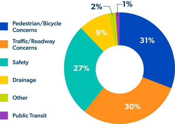
A questionnaire was presented as an introductory part of the interactive mapping survey. People who participated in interactive mapping were prompted to complete this questionnaire that gathered feedback on corridor improvement recommendations. Of all respondents, the majority (81%) reported living close by, working near, and regularly using the corridor. Of those who live near the corridor, 36% of participants reported living in the Village of La Grange but working outside the Corridor’s area. When asked about their top transportation priority, 31% of respondents identified that pedestrian and bicycle Conditions are their leading concern. Please see the graphic to the right for the distribution of all participant responses. |
|
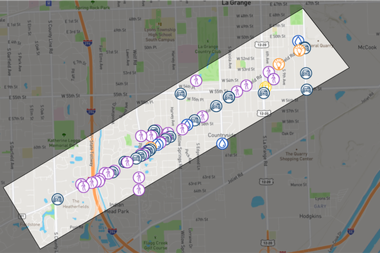
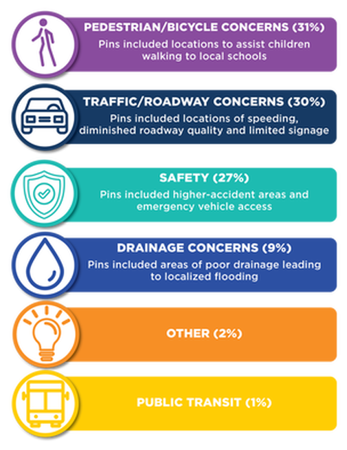
INTERACTIVE MAPPING The Plainfield Road Interactive Map enabled participants to add pins and comments to specific areas on the corridor’s digital map. Most people added pins that highlighted pedestrian/bicycle concerns followed by traffic/roadway concerns. Additionally, some survey participants labeled pins on the map as their top priority items, giving those pins more substantial weight. Please see the graphics below and to the right for the distribution of pins placed across the map. |


